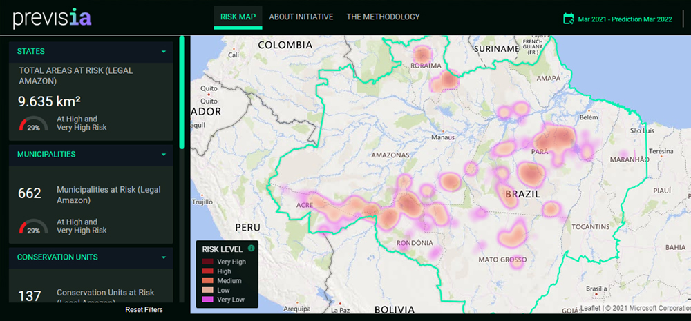
Launched in August 2021, the PrevisIA platform is the result of a partnership between the Institute for the Amazon’s People and Environment (Imazon), Fundo Vale and Microsoft to identify areas at risk of deforestation in the Amazon before it happens. The tool uses satellite images, artificial intelligence and a lot more science and technology. Fundo Vale and Imazon have just signed a new partnership agreement, focused on engaging users and updating the platform’s data.
The goal is to provide information to decision makers and those involved in initiatives to tackle deforestation, allowing them to act more strategically by focusing on the areas where deforestation is most likely to occur.
PrevisIA analyzes a variety of data, encompassing topography, land cover, urban infrastructure, official and unofficial roads, and socioeconomic indicators, to identify possible deforestation trends. Using this tool, it is possible to pinpoint the regions at greatest risk of deforestation before it happens and then take preventive and protective measures.
In the 2021/2022 cycle, the platform identified that 15,391 km² of habitat in the Amazon region is at high or very high risk of deforestation. The biggest challenge is in Pará, the state with the largest area at risk: 6,288 km² or 41% of the total threatened area in the Amazon. Next is Amazonas (17%), followed by Mato Grosso (15%), Rondônia (11%) and Acre (9%).
In November 2021, Imazon entered into a partnership with the Pará State Public Prosecutors’ Office and its Environmental Operational Support Center to begin a pilot project in Altamira, one of the top 10 municipalities in terms of deforestation in the Amazon, in order to provide technical support, cooperation and information sharing. Imazon subsequently signed similar partnership deals with the state public prosecutors’ offices of Acre, Amapá and Mato Grosso.
“We believe in using science and technology together with reliable information for strategic decision making in the fight against deforestation in the Amazon. That is what PrevisIA allows. At the end of the day, the platform will be deemed a success if these predictions do not come to pass, if we manage to take more effective action,”
Márcia Soares, Fundo Vale’s partnership leader
You can access the PrevisIA tool here: previsia.org
